
News
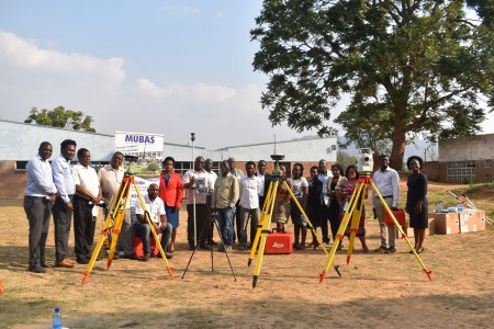
The Department of Land Surveying and Physical planning now has the following equipment which was procured for its use by management, The Equipment include;
1. Normal Total Station
A total station is an optical instrument commonly used in construction, surveying and civil engineering. It is useful for measuring horizontal angles, vertical angles and distance — it does this by analysing the slope between itself and a specific point. Total station is particularly useful for performing functions like these;
2. Robotic Total station
The uses of normal total station and robotic total station are similar; the only difference is in its functionality during the field work. Robotic total stations allow for more technological convenience. They offer extended remote control abilities, they need only one operator compared to normal Total Station which needs two or more, and they allow for increased safety in challenging terrain because of their unique ability to operate at a distance.
3. Global Positioning System (GPS)
From mining to aviation, agriculture to marine, recreation to defense, there are many applications for GPS technology. These days, everyone from doctors, scientists, farmers, soldiers, pilots, hikers, delivery drivers, sailors, fishermen, dispatchers, athletes, and people from many other walks of life are using GPS systems in ways that make their work more productive, safer, and easier. The following are applications of GPS in Surveying and Construction industry;
4. Laser scanner
Laser scanning is a very efficient survey method to reduce costs. Surveys are realized by a laser scanner, which allows a fast surveying (scanning) of landscapes, structures and their furnishings and arrangements as well as installations. Laser scanners are also used for 3D surveys of large components and complex structures.
Laser scanning expands survey to the following fields;
5. Drone
In surveying, drones are used to capture aerial data with downward-facing sensors, such as RGB or multispectral cameras and LIDAR payloads. During a drone survey with an RGB camera, the ground is photographed several times from different angles, and each image is tagged with coordinates. Drone surveys are extensively used in the following;